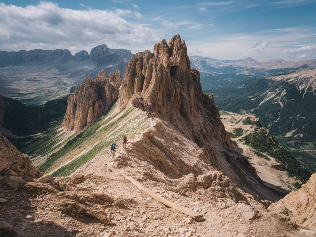
I’ve spent weeks tracing ridgelines, scrambling over limestone towers and losing track of time among cloud-shrouded passes—so when I talk about sentiers de montagne dans les Dolomites, I speak from boots-on-the-ground experience. The Dolomites are less a single mountain range than a constellation of dramatic spires, plateaus and verdant valleys, and the hiking routes here reward patience with panoramas that are unmatched in Europe.
Why the Dolomites? What makes these mountain trails special
There are three reasons I keep coming back to these trails: the geology, the diversity of routes and the network of rifugi (mountain huts). The Dolomite rock—pale, vertical and often eroded into toothlike pinnacles—creates landscapes that look like they belong in a painting. Trails range from gentle valley walks to exposed via ferrata that require a helmet and harness. Rifugi spaced every few hours turn multi-day itineraries into achievable adventures without heavy campsite gear.
Quick stats to orient yourself
- Altitude range: 500–3,342 m (Marmolada)
- Total marked trails: Approx. 1,200+ official trails across the region (local CAI and provincial maps)
- Average summer conditions: Late June–September is prime (snow-free on most main ridges)
- Popular hubs: Cortina d'Ampezzo, Val Gardena, Alta Badia, Arabba
How I choose a route: practical criteria
When I plan a day or multi-day hike I weigh four factors: technical difficulty, elevation gain, exposure (how much vertical drop is visible), and logistics (public transport, rifugi availability). I also carry a topo map (Tabacco or Kompass) and the local CAI trail list, and I check weather with meteo.it or the regional park pages before leaving.
Best routes I recommend (balanced by difficulty)
Below are routes I’ve hiked or scouted that showcase different facets of the Dolomites.
- Easy / Scenic: Tre Cime di Lavaredo loop — 3–4 hours, 10–12 km, ~300 m gain. Iconic views with accessible path; busy but unforgettable.
- Moderate: Seceda ridge from Ortisei — 6–7 hours (round trip if you include alternate ridgelines), panoramic ridges and pastureland, great for sunrise photos.
- Challenging: Alta Via 1 (multi-day classic) — ~120 km over 10–12 stages, alpine terrain, long ascents and descents; requires planning but has excellent rifugi spacing.
- Technical / Via ferrata: Via ferrata Ivano Dibona (Cristallo) — exposed, historic WWI route with cable and ladders; helmet and harness recommended.
- Wild & remote: Fanes-Senes-Braies loop — multiple days across varied terrain, lesser crowds than Tre Cime.
Sample comparison table: pick the right trail for your trip
| Route | Duration | Difficulty | Best season | Notes |
|---|---|---|---|---|
| Tre Cime di Lavaredo loop | 3–4 h | Easy–Moderate | Jun–Sep | Short, iconic, can be crowded |
| Seceda ridge | Half–Full day | Moderate | Jun–Sep | Great sunrise photo ops; cable car option |
| Alta Via 1 | 10–12 days | Challenging | Jul–Sep | Network of rifugi; requires reservations |
| Ivano Dibona via ferrata | Full day | Technical | Jul–Sep | Historic, exposed; bring harness |
Packing and safety tips for Dolomite mountain trails
I adopt a light-but-safe approach: 3-season sleeping bag for rifugi nights, a down jacket, waterproof shell, map + compass, headlamp, and at least 2 liters of water. For via ferrata or exposed ridges I bring a harness, lanyard with energy absorber, helmet and gloves.
- Footwear: Sturdy hiking boots with good grip; some scree sections require ankle support.
- Navigation: Paper map + offline GPS app (Maps.me, Gaia, or Komoot offline tracks).
- Sun & weather: High UV and fast storms—pack sunscreen, sunglasses and layers.
- Rifugi etiquette: Reserve ahead in high season; carry small change for coffee and snacks.
Mountain hazards and local rules
Weather can turn quickly above 2,000 m. Thunderstorms are most frequent in late afternoon. Stonefall in steep limestone gullies is a real hazard—avoid narrow couloirs after freeze-thaw cycles. Respect private pastures and grazing closures; in many valleys dogs, cows and sheep graze freely.
How to plan multi-day treks—my workflow
For an Alta Via or multi-refuge trek I plan like this:
- Choose stages by daily distance and elevation with a buffer for bad weather.
- Book rifugi 2–3 months ahead in July–August.
- Pack light—refuge beds only require a light liner and sometimes socks.
- Leave an itinerary with someone and note contact numbers for mountain rescue (118 in Italy).
Three external sources I rely on
- Dolomiti.org — Official tourist information
- Club Alpino Italiano (CAI)
- Local guides and via ferrata information (example guide sites)
Conservation and responsible hiking
I take the Leave No Trace principles seriously here. The Dolomites are a UNESCO World Heritage site—stick to marked trails, avoid collecting rocks or plants, and use rifugi toilets rather than makeshift solutions. Supporting local rifugi and mountain guides helps maintain trails and the local mountain economy.
Best time of year and crowd management
Late June to early September is the main season. If you want fewer people and alpine flowers, aim for late June or September shoulder weeks. For snow-free via ferrata and high passes, July–August are most reliable. If you crave solitude, try lesser-known valleys like the Fanes or Schiara group; they’re quieter but still spectacular.
Gear recommendations I actually use
- Lightweight mountaineering boots (La Sportiva or Scarpa)
- Harness + via ferrata lanyard (Petzl)
- Compact mirrorless camera for ridge photography (Fujifilm X-series)
- Tabacco 1:25,000 topo maps for the Dolomites
Sample day itinerary — Tre Cime at sunrise (what I do)
I drive or take the early bus to Rifugio Auronzo, hike the counterclockwise loop before the crowds, pause at the north face viewpoint at dawn, and return via the lower path to catch light on the southern faces. Coffee at Rifugio Auronzo tastes better at 7 a.m. than anywhere else.
Further reading and route planning tools
For route descriptions and up-to-date trail conditions I use a combination of the CAI online pages, local rifugi websites, and user-tracked routes on Komoot or AllTrails. Official park pages for Dolomiti Bellunesi and the Fanes-Senes-Braies park often have current alerts about trail closures or rescues.
If you want detailed stage plans, maps or a suggested packing list tailored to a specific route—say Alta Via 1 vs Tre Cime—tell me which trail and dates you’re considering and I’ll draft a day-by-day plan with campsite/refuge options and public transport links.
Sources: Dolomiti.org, Club Alpino Italiano, Meteo.it.